Coos County Odyssey 2024–and 2024 First Day Hikes

Coos County Odyssey 2024–and 2024 First Day Hikes

Register for Coos County Odyssey 2024

The virtual “race” starts on January 1 and goes through April 15.  It’s a fun way to achieve your fitness goals in the new year.  You can choose from many types of actual exercise to calculate your virtual miles, and this 3rd Odyssey has new milestones to reach in your 229-mile route around Coos County.  Participate as an individual or form teams with friends, family or colleagues to motivate each other to achieve your goals. The entry fee is $25 (plus a $2.50 processing fee).  All proceeds go to the Coos County Friends of Public Health for the Nurses’ Purse Fund, which helps families in need in Coos County.  

Let’s get moving in 2024!  

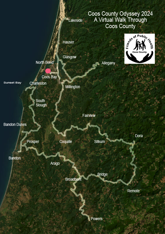
When you register, you can join a team (like the South Coast Striders), register as an individual, or start your own group or team.

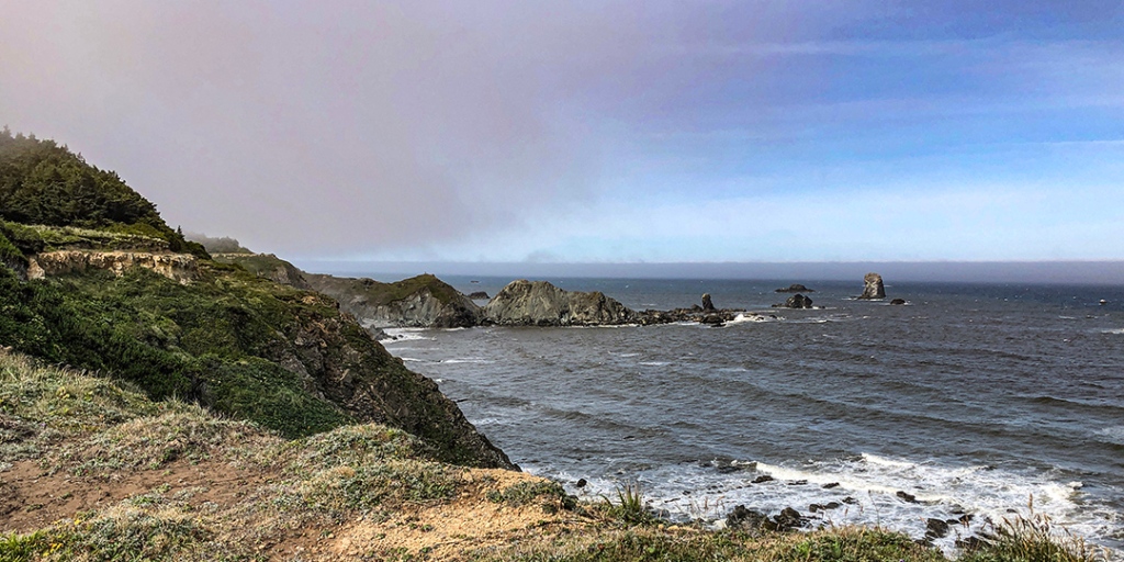
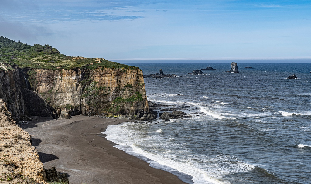
Nearby First Day Hikes

Enjoy one of the Oregon State Parks First Day hikes on January 1, 2024

Bullards Beach State Park 1:00 PM

Jessie M. Honeyman Memorial State Park 9:00 AM

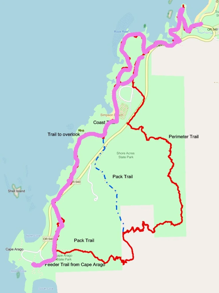
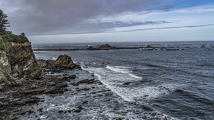
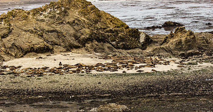
Shore Acres State Park 10:00 AM

William M. Tugman State Park 1:00 PM

Umpqua Lighthouse State Park 10:00 AM

With a little bit of planning it may be possible to do two of these hikes.

Click on the hikes for more details

Bastendorff Bog Hike–Friday, November 24, 2023

Bastendorff Bog Hike–Friday, November 24, 2023

Note: Registration Required. Register HERE

Opt Outside on Black Friday 2023, and join us for a hike (good for working off the Thanksgiving feast).

Bastendorff Bog trail hike out and back, with some additional hiking in the area.

The hike will start in the Sunset Bay Day Use area.  We’ll hike from there, cross Cape Arago Hwy, go through the campground, and follow the bog trail out to Yoakam Point, which will provide an excellent view of Cape Arago Lighthouse, and a mystery feature pictured below.   We will all then return to the starting point, and those wanting a longer hike will continue hiking (on their own) along the coast to Shore Acres and back.  You’ll see some great ocean views and very interesting trees along the way.

Be prepared for any weather conditions with foul weather gear, food and water. Moderate, ~ 4-5 mostly flat miles.

Note that the 9:30 start time will give you the opportunity to shop local in your home town after the hike.

Register Here

Location and Time

Meet 9:30 am at day use parking lot, near volley ball courts and restrooms at south end of Sunset Bay. 

Driving Directions:  From Hwy 101 in downtown Coos Bay follow the signs 12.3 miles through Charleston to Sunset Bay State Park.  Park in the day use parking lot.

Walkable North Bend–January 29, 2022(Saturday, 9:30)

Walkable North Bend–January 29, 2022(Saturday, 9:30)

Also, this hike will be a ‘Weather Permitting’ hike, and my be cancelled if the weather is bad.

Description

Explore some of the many paths and trails commonly used by the folks in North Bend both past and present.

You can join local author and historian Dick Wagner on an easy to moderate 2 mile loop  from Ferry Park, along Bayview Ave and back up into town, before walking through Simpson Park, past the North Bend Visitor Center, under the McCullough Bridge, and then returning through the woods to Ferry Park.  Dick literally ‘wrote the book’ (or books) on North Bend History.

This hike should last about 2 hours.

OR

There will be a 5.5 mile loop at a little brisker pace (and less history) on the North Bend loop portion of the new Sawmill & Tribal Trail.

This walk will also start at Ferry Road Park, and head out under the McCullough Bridge, and along the Sawmill & Tribal Trail to post #12 on Pony Creek Rd then up the stairs at Lombard and along McPherson to the North Bend Boardwalk then back to Ferry Road Park.

This hike is rated difficult (due to steps) and should last 3—3.5 hours.

Location and Time

We will meet at 9:30 in the Ferry Road Park parking lot.

Directions:  Ferry Road is just South of the McCullough Bridge. If you are heading South it will be your first left. If you are heading North, it will be on the right, just past the North Bend Visitor Information Center.

McCullough Bridge

Sign Up For Coos County Odyssey 2022

Sign Up For Coos County Odyssey 2022

Will You Resolve to Get More Exercise in 2022?

Coos Odyssey is a perfect way to keep track of your exercise achievements in the new year. You can follow your progress on a virtual map as you log miles based on your activities. For example:

  • Log a mile for every mile hiked
  • Log a mile for 30 minutes of Yoga
  • Log a mile for 30 minutes of gardening (as long as you keep working)
  • Two laps around Mingus Park earns 1.2 miles
  • Sunset Bay to Cape Arago and back earns 8.5 miles
  • A 60 minute paddle on Eel Lake earns 2 miles
  • …and so on

There is a ‘Team’ for South Coast Striders. Choose that team when you sign up (or, if you want, create your own team made up of colleagues, friends, or families).

Coos County Odyssey 2022

Coos County Odyssey 2022

“Race” around Coos County, Oregon in this virtual odyssey that will take the participants through some of the most unique locations in the county.

Participants can exercise in a number of different ways (walk, hike, run, bike, paddle, yoga, pickleball, golf, ski…) to earn miles on the virtual platform.

You report the miles you walk, or take the equivalent credit for other exercise activities, and your progress will take you along the map below. You will receive virtual badges at each location.

Some Key Information About the Challenge

  • It’s a ‘Virtual’ event. You don’t actually travel the route. You walk or hike wherever you want and credit those miles to advance on the route.
  • It’s more than walking. Almost any physical activity can earn you credit. In many cases, 30 minutes of sustained activity earns you a mile.
  • During the sign-up process you have the option to join or form a team. Teams encourage each other to complete the challenge.
  • It isn’t a race. Everyone who completes the challenge will be a winner.
  • This event is open to anyone, anywhere. Because it’s virtual you might earn miles by paddling in the Everglades, or walking the streets of a European city.

You can form teams and compete with and motivate your friends and family to start the year off right, achieving your fitness goals, while helping families get access to nutritious food and professional advice on nutrition. 

The Coos County Friends of Public Health are hosting this event and all proceeds will go to the local Women, Infants, & Children (WIC) Special Supplemental Nutrition program benefiting expecting mothers and children. 

Sweet Creek Falls Hike, Oct. 30

Sweet Creek Falls Hike, Oct. 30

Saturday, October 30, 2021

This hike is limited to about 15 people. Because there are multiple hikes, we may (if there are enough leaders) break into groups.

Registration Required. Register here

The Hikes: The Sweet Creek/Beaver Creek area offers hikers a smorgasbord mountain stream and waterfalls experience. There will be 4 different hikes all of which are out and back on the same trail and rated moderate.

The first will be a 1/2 mile trip to view Beaver Creek Falls.

The second will be a 1.2 mile hike to a different viewpoint of Beaver Creek Falls.

The third hike will be 1.6 miles to Sweet Creek Falls.

The final and best hike of the day will be a 1.6 mile hike along Sweet Creek on a trail that meanders along the water and actually travels right over the creek on a railed catwalks that is bolted to the side of the canyon.

Altogether, you will hike 4.9 miles for the day.

If you want to take it a little easier you can cut out the third hike and take a break while the rest of the group goes on this section. Since the hikes are all “out and back” you can cut any of the hikes short and return to the parking area if you are getting tired. Plan on 4 hours for all the hikes—starting for home around 2pm.

sweet creek 4

Location and Time

Meet at Dune Information Center in Reedsport at 9:00. We will caravan from there.

Directions: From Coos Bay Visitor Center in downtown Coos Bay travel 26.6 miles N on Hwy 101. Visitor center is on left directly opposite the turnoff for Hwy 38. We will leave from the Dune Information Center at 9:00 and reach the Sweet Creek Falls trail head at 10:30. Some gravel roads and deep pot holes are on our route but we will go easy.

Registration Required. Register here

Sunset Bay to Cape Arago-April

Sunset Bay to Cape Arago-April

Sunday April 25

Requires Registration–Registration Form

This hike is limited to 15 people, but if demand is high (and we have enough leaders) we can stagger start times. Also, there is a short hike option that goes from Sunset Bay to Shore Acres and back.

To volunteer to lead, send an email to hikes@coostrails.com.

Hike Description:   The whole hike goes from Sunset Bay Day Use Area, along the coast through Shore Acres up toward the Simpson Reef Overlook. From there we’ll continue to Simpson Reef and then cross the road to the Pack Trail connector, and on to Cape Arago. Then you can return either by the same route or along the road as far as the Simpson Reef overlook, returning the same way you came. The total hike is about 8.5 miles if we take the shortcuts across the field at Shore Acres and the group campground at Sunset Bay.

Short Hike–This will just go to Shore Acres and back. It will be under four miles, all pretty level. I need a volunteer to lead the short hike…or you will need to return on your own.

Another option–You can hike as far as Simpson Reef, and then return. This will be almost 8 miles, but it’s all level. You’ll be on your own for the return.

The line on the map shows the route we’ll be taking. Note that we’ll be avoiding the Pack Trail because of storm damage.

New Hike Guidelines

  1. Hike groups will be limited to 15 people.
  2. You will be asked to complete a registration form so that we can control the number.
  3. Hikers will be asked to maintain social distance (as much as 10-12 feet) on the trail
  4. Hikers will be asked to have face covering (like a bandana) that can be pulled up at tight spots on the trail
  5. Hikers should step off the trail to let others pass

Other Information

The restrooms at the Sunset Bay Day use area were open the last time I hiked this. There are restrooms at Shore Acres (at about the 2.2 and 7 mile points of the hikes).

For those on the long hike, we’ll be stopping for lunch at Cape Arago. We suggest you might want to snack at the Simpson Reef Overlook, because lunch will be later than usual.

Location and Time

Location and Time

Meet 9:30 am at Sunset Bay day use parking lot, near volley ball courts and restrooms at south end of Sunset Bay.  The short version of the hike will end before noon(unless you spend time in the gardens), and the long version at 2:30.

Driving Directions:  From Hwy 101 in downtown Coos Bay follow the signs 12.3 miles through Charleston to Sunset Bay State Park.  Park in the day use parking lot.

Remember to complete registration form.

Hike Leaders Needed

Hike Leaders Needed

From Tom Orsi:

There are two things that are preventing group hikes from re-starting. The first is the large number of COVID-19 cases in Coos County, which makes it risky to hang out in large groups. That will end soon, so if that was the only problem, hikes would resume.

Unfortunately, the second problem doesn’t seem to be going away. We need people to lead hikes, and the last time I asked for volunteers, only one person came forward. We need several people who are ready to lead. One person can’t lead every hike, and the one person who HAS been leading the hikes needs to step back and either enjoy the hikes from the back, or have the flexibility to do something else on hike days.

To volunteer, send an email to hikes@coostrails.com

I have all the resources to schedule and plan hikes, but I need human resources to lead. Please email me at hikes@coostrails.com about your willingness to lead, and note which hikes you might want to lead. Include your phone number.

Find out about hike leader responsibilities on this page.

Once I have a few people willing to do this, I’ll schedule a Zoom meeting so that we can agree on a schedule.

Some potential hikes that we could schedule soon:

South SloughThis is a fairly easy hike, and it’s a good time of year to do it because the skunk cabbages are in bloom
Sunset Bay to Cape Arago.This will avoid the Pack Trail and the Perimeter Trail, which have some problems with downed trees
Golden and Silver FallsGood flow at this time of year, and wildflowers. We probably won’t do the walk out to the old homestead, opting instead to hike to two viewpoints of each of the falls
Bastendorff BogThis is a hike from Sunset Bay to Yoakum point, a fairly easy hike through the woods followed by some good views at Yoakum Point.
Sweet Creek FallsIt’s a trip to get there, but once there we will see great views along the creek, and multiple viewpoints of the falls.
Tahkenitch DunesCombines woods, dunes, and a beach walk…a little of everything the coast has to offer.
Blacklock Point from Floras LakeA beautiful walk through the woods and along the coast with great views along the way. It’s a well defined trail.
Siltcoos LakeA 4 mile loop through a coastal forest of Sitka Spruce, Western Red Cedar and Douglas Fir to the shores of the largest freshwater lake on the Oregon coast.  The hike can be lengthened with a hike along the Siltcoos River to the beach.
Name your hikeIf there is a hike you want to lead that’s not listed here, just suggest it.

Email hikes@coostrails.com to volunteer as a hike leader!

We Will Continue to Follow Hike Guidelines

  1. Hike groups will be limited to 15 people.
  2. You will be asked to complete a registration form so that we can control the number.
  3. Hikers will be asked to maintain social distance (as much as 10-12 feet) on the trail
  4. Hikers will be asked to have face covering (like a bandana) that can be pulled up at tight spots on the trail
  5. Hikers should step off the trail to let others pass
Oregon Heritage Plan Survey

Oregon Heritage Plan Survey

Greetings,

The Oregon Heritage Commission is updating the Oregon Heritage Plan to strengthen heritage efforts across the state. Take a short survey by October 27 to share what aspects of heritage are important to you!

If you enjoy meeting up at a local brewery in a historic building, attending cultural events or traditions, visiting museums, or researching local history or genealogy, heritage is important to you. Heritage includes valued objects and qualities such as cultural traditions, natural areas and landscapes, and historic buildings that have been passed down from previous generations.

Your input will help shape the Oregon Heritage Plan, which lays the foundation for the Oregon Heritage Commission’s priorities over the next five years. Visit the Oregon Heritage website to learn more about the 2020-2025 Plan and the Oregon Heritage Commission.

Survey Link: https://www.surveymonkey.com/r/LPJG2YL

Walkable North Bend–July 13, 2025 (Sunday, 10:00)

Walkable North Bend–July 13, 2025 (Sunday, 10:00)

We have previously offered this hike in January, when we were at the mercy of Winter weather. A July walk means that you won’t need to bundle up.

Description

Explore some of the many paths and trails commonly used by the folks in North Bend both past and present.

You can join local author and historian Dick Wagner on an easy to moderate 2 mile loop  from Ferry Road Park, along Bayview Ave and back up into town, before walking through Simpson Park, past the site of the former North Bend Visitor Center, under the McCullough Bridge, and then returning through the woods to Ferry Park.  Dick literally ‘wrote the book’ (or books) on North Bend History.

This hike should last about 2 hours

Location and Time

We will meet at 10:00 on Sunday, July 13 in the Ferry Road Park parking lot.

Directions:  Ferry Road is just South of the McCullough Bridge. If you are heading South it will be your first left. If you are heading North, it will be on the right, just past the site of the former North Bend Visitor Information Center.

McCullough Bridge

Coos County Odyssey 2025

Coos County Odyssey 2025

Register for Coos County Odyssey 2025

The virtual “race” starts on January 1 and goes through April 15.  It’s a fun way to achieve your fitness goals in the new year.  You can choose from many types of actual exercise to calculate your virtual miles, and this 3rd Odyssey has new milestones to reach in your 253-mile route around Coos County.  Participate as an individual or form teams with friends, family or colleagues to motivate each other to achieve your goals. The entry fee is $20 (plus a processing fee).  All proceeds go to the Coos County Friends of Public Health for the Nurses’ Purse Fund, which helps families in need in Coos County.  

Let’s get moving in 2025!  

When you register, you can join a team (like the Striders and Friends), register as an individual, or start your own group or team.

After you have signed up for Coos County Odyssey a good way to start the year will be to take a FIRST DAY HIKE. See the list of nearby first day hikes HERE.

First Day Hikes 2025

First Day Hikes 2025

There are a number of First Day Hikes on New Years Day, starting at 8:00 AM in Bandon. Click on the names to find out the details.

For those of you who like to get a couple of hikes in, it would appear that the Umpqua Lighthouse coupled with William Tugman might be the best pairing. Of course you might be able to pair the Shore Acres and Tugman…just don’t speed between the two!

Black Friday Hike–Friday, November 29, 2024

Black Friday Hike–Friday, November 29, 2024

Note: Registration Required. Register HERE

Opt Outside on Black Friday 2024, and join us for a hike (good for working off the Thanksgiving feast).

We will either do Sunset Bay to Shore Acres, or the Bastendorff Bog trail hike out and back (or both, for those who are energetic). I’m uncertain about which because I haven’t scouted the trails yet.

If we do Sunset Bay to Shore Acres:

We will start at the Sunset Bay Day Use area. We’ll climb up the hill, and hike around the group campsite, following the coast trail with great views from the coastline. After Shore Acres we may continue along the coastline for more ocean views. Then we’ll return via a slightly different route.

If we do Bastendorff Bog:

The hike will start in the Sunset Bay Day Use area.  We’ll hike from there, cross Cape Arago Hwy, go through the campground, and follow the bog trail out to Yoakam Point, which will provide an excellent view of Cape Arago Lighthouse, and a mystery feature pictured below.   We will all then return to the starting point. If we do this hike you can always add the Sunset Bay to Shore Acres route on your own. It’s well marked.

Be prepared for any weather conditions with foul weather gear, food and water. Trails are likely to be muddy. Moderate, ~ 4-5 mostly flat miles.

Register Here

Location and Time

Meet 10:00 am at day use parking lot, near volley ball courts and restrooms at south end of Sunset Bay. 

Driving Directions:  From Hwy 101 in downtown Coos Bay follow the signs 12.3 miles through Charleston to Sunset Bay State Park.  Park in the day use parking lot.

To the Bogs and Back–Bandon 2024

To the Bogs and Back–Bandon 2024

Saturday, October 19, 2024 (10:00 AM)

To help us know how many to expect at the hike, please register here

Visit the Bogs…and More

Join us for an in-town hike on the wilder side of Bandon. Follow sidewalks, quiet streets and pathways on a 2.5-mile loop that leads from the Bandon History Museum to a good vantage point to see some cranberry bogs during harvest season. Museum volunteer Jim Proehl will share some “History Minutes” along the way. Expect a sojourn in a cemetery as part of this October hike. Extend the walk by picking up one of several “Healthy, Historic Hike” maps at the museum and following another route through historic Bandon. 

Park in the museum parking lot and if that fills up, park in the public lot at Face Rock Creamery or on adjacent streets.

You’ll visit the site of this History Minute:

See a brochure and map about the hike.

Harvesting Cranberries
https://player.vimeo.com/api/player.js

We got lucky on last year’s hike, and watched a live harvest. We can’t promise that this year, but it’s always possible!

Register Here

Location and Time

We will meet at 10:00 in Public Parking lot of the Bandon Historical Society Museum. If the lot is full you can find additional parking behind the Face Rock Creamery  Map Link to Museum and additional parking area.

Directions – The museum is on the corner of Highway 101 and Fillmore Ave.

Sweet Creek Falls Hike, October 5, 2024

Sweet Creek Falls Hike, October 5, 2024

Saturday, October 5, 2024

Registration Required. Register here

The Hikes:  The Sweet Creek/Beaver Creek area offers hikers a smorgasbord mountain stream and waterfalls experience.  There will be 3 different hikes all of which are out and back on the same trail and rated moderate.

  • The first will be a 1.2 mile hike to a viewpoint of Beaver Creek Falls.
  • The second hike will be 1.6 miles to Sweet Creek Falls. Note–There was a tree blocking the trail, but it has been cleared. The root ball that’s left is slippery, but passable.
  • The final and best hike of the day will be a hike along Sweet Creek on a trail that meanders along the water and is a chance to see tributary falls that feed the creek, as well as the main attraction. This hike will be a little different from past hikes on this trail. There is a bridge failure along the way, so we’ll be starting at the second parking lot. We’ll still see some gorgeous views.

All together you will hike 4.6 miles for the day as you enjoy 3 beautiful waterfall views.

Since the hikes are all “out and back” you can cut any of the hikes short and return to the parking area if you are getting tired. Plan on 4 hours for all the hikes—starting for home around 2pm.

Bring lunch and water and rain gear, dress in layers, and wear sturdy boots (waterproof is good

sweet creek 4

Location and Time

Saturday, October 5–Meet at Oregon Dunes Visitor Center in Reedsport at 9:15. We will consolidate, if possible, and caravan from there, so arrive early so that we can group up.

Directions: From Coos Bay Visitor Center in downtown Coos Bay travel 26.6 miles N on Hwy 101. Visitor center is on left directly opposite the turnoff for Hwy 38.   We will consolidate vehicles and leave from the Dunes Visitor Center at 9:15, reaching the Beaver Creek Falls trail head at about 10:30 (with one rest stop along the way). 
Note: If you want to meet us at the trailhead, you can plan to be at the Wagon Road Trailhead at 10:30. Let us know if you plan to do this. (There is a space on the registration form to do this)

Registration Requested. Register here

Bandon Historical Hike 2024

Bandon Historical Hike 2024

Sunday, August 25, 2024

To help us plan the hike, please register here

Hike Bandon’s History

Archaeologist and historian, Reg Pullen will lead a three mile walking tour of Bandon, including Old Town and the beach near the South Jetty.

Reg will share all the local lore and colorful history of Bandon while touring various historical points of interest. Starting at the Museum, you’ll tour the waterfront and Old Town before heading to the beach. From the beach you can choose to walk down the beach on your own, or return to town via the Jetty road. The total hike is 3 miles, rated moderate, with some sand walking involved and should last 2.5 to 3 hours. You can shorten the walk by leaving it before the trip to the beach.

After the hike you may want to visit the Bandon Historical Society Museum. Because this is on a Sunday, admission will be FREE, thanks to the “Free Summer Sundays” program sponsored by First Interstate Bank and Best Western Inn at Face Rock. 

Location and Time

We will meet at 9:30 in Public Parking lot of the Bandon Historical Society Museum. If the lot is full you can find additional parking behind the Face Rock Creamery  Map Link to Museum and additional parking area.

Directions – The museum is on the corner of Highway 101 and Fillmore Ave.

To help us plan the hike, please register here

Blacklock Point from Airport Road, Saturday, July 27

Blacklock Point from Airport Road, Saturday, July 27

Requires Registration–Registration Form

This hike is just over 5 miles long, across fairly level terrain, with great views along the way.

For this hike we’ll start at the Cape Blanco State Airport (see directions below), and hike parallel to the runway for a while before heading North, and then looping around toward the shoreline, where we’ll have some of the hike’s best views. Then we’ll continue to Blacklock Point, returning by a shorter trail.

There will be a short option that starts along the same path as the rest of the group, but skips the longer loop, proceeding directly to Blacklock Point. That is an out and back hike, totaling 4 miles altogether.

The differences are shown on the map below.

Dress in layers, windbreaker with a hood is highly recommended.  Bring water and something to eat (lunch or a snack.). There are no restrooms at the trailhead, but there are several well protected areas along the way.

Plan on 3 hours for this hike, depending on how clear the day is (there are lots of photo opportunities on a clear day, which could slow us down).

Hike Guidelines

  1. Hike groups will be limited to about 15 people. That’s to make it easier to keep track of everyone as we reach turns.
  2. You will be asked to complete a registration form so that we can control the number.

Location and Time

Meet at 10:00 on Saturday, July 27 at the trailhead just outside of the Cape Blanco Airport Entrance. For those of you heading south on 101, you will turn on Airport Road, about 20 miles south of Bandon. Then follow Airport Road for about 3 miles. If you’re heading North, the turn on Airport Road is about 7.2 miles from Port Orford. Airport road is directly across from Pacific High School.

There are two parking areas. The one on the left isn’t as obvious, but if there are a lot of cars, we may need to use it.

Remember to complete registration form.

Sunset Bay to Cape Arago, June 29, 2024

Sunset Bay to Cape Arago, June 29, 2024

Saturday, June 29, 2024

We try to keep the numbers on our hikes small, so they will be limited to 15-20 people. Please sign up if you plan to join us.

WE NEED HIKE LEADERS–We can’t plan hikes without leaders. That’s one reason why there have been so few hikes this year.

To volunteer to lead, send an email to hikes@coostrails.com.

Hike Description:   The whole hike goes from Sunset Bay Day Use Area, along the coast through Shore Acres up toward the Simpson Reef Overlook. From there we’ll continue to Simpson Reef and then cross the road to the Pack Trail connector, and on to Cape Arago. That will be a good spot to have lunch. Then you can return either by the same route or along the road as far as the Simpson Reef overlook, returning the same way you came. The total hike is about 8.5 miles if we take the shortcuts across the field at Shore Acres and the group campground at Sunset Bay.

Short Hike–This will just go to Shore Acres and back. It will be under four miles, all pretty level. I need a volunteer to lead the short hike…or you will need to return on your own.

Another option–You can hike as far as Simpson Reef, and then return. This will be almost 8 miles, but it’s all level. You’ll be on your own for the return.

The line on the map shows the route we’ll be taking. Depending on a group decision, we MAY take the Pack Trail from Cape Arago (the red to the blue broken line).

Other Information

Restrooms are available at Sunset Bay and Shore Acres.

For those on the long hike, we’ll be stopping for lunch at Cape Arago. We suggest you might want to snack at the Simpson Reef Overlook, because lunch will be later than usual.

Location and Time

Location and Time

Meet 9:30 am at Sunset Bay day use parking lot, near volley ball courts and restrooms at south end of Sunset Bay.  The short version of the hike will end before noon(unless you spend time in the gardens), and the long version at 2:30.

Driving Directions:  From Hwy 101 in downtown Coos Bay follow the signs 12.3 miles through Charleston to Sunset Bay State Park.  Park in the day use parking lot.

Remember to complete sign-up form