Tag: Coos Hikes

To the Bogs and Back–Bandon 2024

To the Bogs and Back–Bandon 2024

Saturday, October 19, 2024 (10:00 AM)

To help us know how many to expect at the hike, please register here

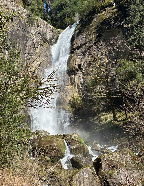
Visit the Bogs…and More

Join us for an in-town hike on the wilder side of Bandon. Follow sidewalks, quiet streets and pathways on a 2.5-mile loop that leads from the Bandon History Museum to a good vantage point to see some cranberry bogs during harvest season. Museum volunteer Jim Proehl will share some “History Minutes” along the way. Expect a sojourn in a cemetery as part of this October hike. Extend the walk by picking up one of several “Healthy, Historic Hike” maps at the museum and following another route through historic Bandon. 

Park in the museum parking lot and if that fills up, park in the public lot at Face Rock Creamery or on adjacent streets.

You’ll visit the site of this History Minute:

See a brochure and map about the hike.

Harvesting Cranberries
https://player.vimeo.com/api/player.js

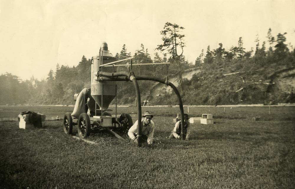
We got lucky on last year’s hike, and watched a live harvest. We can’t promise that this year, but it’s always possible!

Register Here

Location and Time

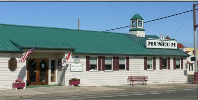
We will meet at 10:00 in Public Parking lot of the Bandon Historical Society Museum. If the lot is full you can find additional parking behind the Face Rock Creamery  Map Link to Museum and additional parking area.

Directions – The museum is on the corner of Highway 101 and Fillmore Ave.

Golden and Silver Falls Hike, Saturday, March 30 , 2024

Golden and Silver Falls Hike, Saturday, March 30 , 2024

Hike Description: Here is a chance to view two beautiful nearby falls.

Registration Form

Short Option: We will make a 2.8 mile round trip hike that climbs a switchback trail through old growth forest of Douglas Fir, Big Leaf Maple and Oregon Myrtle trees up past two beautiful waterfalls both of which are over 100 ft. This should also be a great time of year for wildflowers.

Longer Option: For those wanting a longer hike we will be approaching the falls from different trails.

Silver Falls

Bring lunch and water and rain gear, dress in layers, and wear sturdy waterproof boots. The longer option may get your feet wet at times.

Location and Time

We will meet at Golden and Silver Falls trail head at 10:00.

Please Register for this hike

Directions: From the Coos Bay Visitor Center take Hwy 101 south. Turn left on Newport Ave/ Coos River Hwy. Continue for .5 mile – cross the bridge then bear 90 degrees left onto 6th Ave/Coos River Hwy. The road will make another 90 degree turn to the right and you will pass the Coach House Restaurant on your right shortly after that. Continue for .5 mile and turn right onto D Street/Coos River Hwy at the stop sign. You are following the signs to Allegany. Continue .8 mile and bear left across the bridge onto S. Coos River Hwy. Continue 1.5 mile then turn left on East Fork Millicoma Rd. and cross bridge. After bridge turn right and continue on East fork Millicoma Rd. for 19 miles through the town of Allegany before turning left onto gravel Glen Creek Rd. Continue on Glen Creek Rd for 3 miles to parking area.

Golden Falls
Kentucky Falls Hike–Saturday, July 23

Kentucky Falls Hike–Saturday, July 23

Registration required. REGISTER HERE

The Main Hike

This hike is to Kentucky Falls and back. Kentucky Falls area offers views of 3 waterfalls two of which drop over 100 feet.  The hike is 2.5 miles down to the falls through old growth Douglas Fir and Hemlock. We’ll view the falls and then hike 2.5 miles back on a switchback trail.  It is rated moderate to difficult.  The difficulty is based on the elevation gain, but you can control the difficulty with lots of rests. Plan on 3.5 hours to complete the hike with plenty of time to relax, eat lunch, enjoy the falls and then walk back up the switch back trail at your leisure.

This is a beautiful hike through old growth forest. Even without the falls it would be a great hike.

Pack a lunch to enjoy either during or after the hike. The drive to and from the trailhead is a long, slow drive. (gravel roads). We will be caravaning from the Dunes Information Center in Reedsport, but to get an idea of the route, check out the directions at the trailhead site.

Optional Additional Hike

After we complete the Kentucky Falls hike, some hikers may wish to stop at the North Fork Smith River Trailhead and hike along along the river (out and back). From last reports, the trail may be overgrown with downed trees. That’s one reason why we aren’t offering the traditional through hike from Kentucky Falls to this trailhead. The other reason is that the necessary shuttle adds a lot of travel time.

By going out and back from the trailhead, hikers who want to do this additional hike can go as far as they want, and turn around.

Location and Time

We will leave the Dune Information Center parking lot in Reedsport at 8:30 AM.  Please arrive ten to fifteen minutes before that to sign in and coordinate cars.

Directions – From Coos Bay Visitor Center in downtown Coos Bay travel 26.6 miles N on Hwy 101. Visitor center is on left directly opposite the turnoff for Hwy 38.  We will leave from the Dune Information Center at 8:30 and reach the Kentucky Falls trail head around 10:00.  Some gravel roads and pot holes are on our route so we will go easy.

With Help, Hikes Will Resume Soon

With Help, Hikes Will Resume Soon

Hikes have been cancelled since March. I am about to start scheduling hikes again, but to make that possible, there will be certain guidelines to keep all your fellow hikers comfortable:

  1. Hike groups will be limited to 15 people.
  2. You will be asked to contact me via email or Facebook so that I can control the number
  3. Hikers will be asked to maintain social distance on the trail
  4. Hikers will be asked to have face covering (like a bandana) that can be pulled up at tight spots on the trail
  5. Hikers should step off the trail to let others pass
  6. First hikes on the schedule will be nearby so there won’t be a need for carpooling

NEED LEADERS!

To keep the group sizes smaller, I would like to offer multiple options for each hike (staggered start times, and different routes). In order to do that, I need people to lead the options.

If you would like to lead a hike, please email me at hikes@coostrails.com, and include your contact information:

Name:

eMail address:

Phone Number (cell is best):

Hike or trail you can lead:

For a reminder of hiking trails in the region, visit this list.