Register for Coos County Odyssey 2025
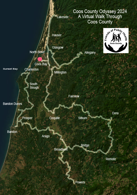
The virtual “race” starts on January 1 and goes through April 15. It’s a fun way to achieve your fitness goals in the new year. You can choose from many types of actual exercise to calculate your virtual miles, and this 3rd Odyssey has new milestones to reach in your 253-mile route around Coos County. Participate as an individual or form teams with friends, family or colleagues to motivate each other to achieve your goals. The entry fee is $20 (plus a processing fee). All proceeds go to the Coos County Friends of Public Health for the Nurses’ Purse Fund, which helps families in need in Coos County.
Let’s get moving in 2025!
When you register, you can join a team (like the Striders and Friends), register as an individual, or start your own group or team.

After you have signed up for Coos County Odyssey a good way to start the year will be to take a FIRST DAY HIKE. See the list of nearby first day hikes HERE.