We have previously offered this hike in January, when we were at the mercy of Winter weather. A July walk means that you won’t need to bundle up.
Description
Explore some of the many paths and trails commonly used by the folks in North Bend both past and present.
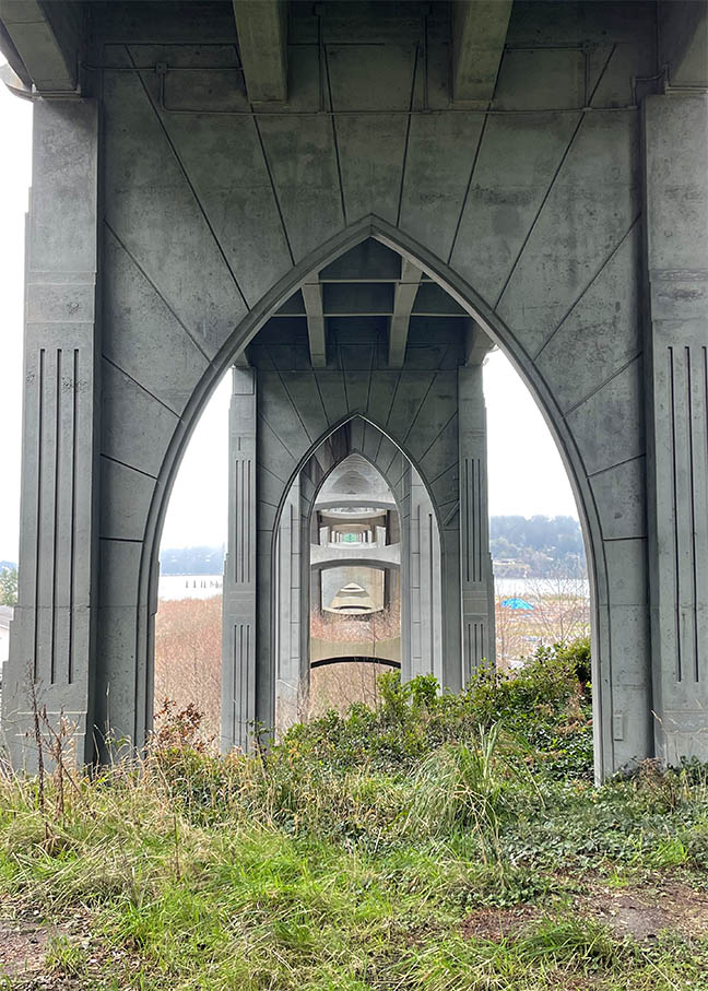
You can join local author and historian Dick Wagner on an easy to moderate 2 mile loop from Ferry Road Park, along Bayview Ave and back up into town, before walking through Simpson Park, past the site of the former North Bend Visitor Center, under the McCullough Bridge, and then returning through the woods to Ferry Park. Dick literally ‘wrote the book’ (or books) on North Bend History.
We will meet at 10:00 on Sunday, July 13 in the Ferry Road Park parking lot.
Directions: Ferry Road is just South of the McCullough Bridge. If you are heading South it will be your first left. If you are heading North, it will be on the right, just past the site of the former North Bend Visitor Information Center.
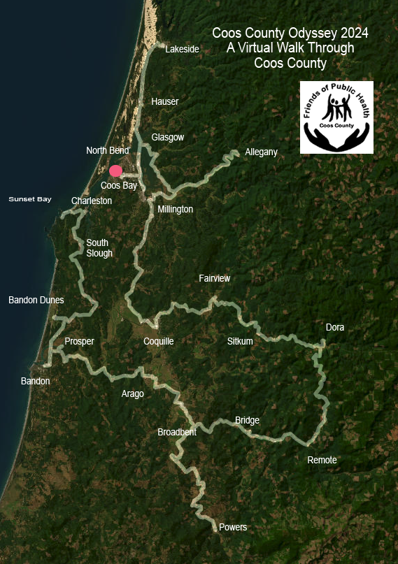
The virtual “race” starts on January 1 and goes through April 15. It’s a fun way to achieve your fitness goals in the new year. You can choose from many types of actual exercise to calculate your virtual miles, and this 3rd Odyssey has new milestones to reach in your 253-mile route around Coos County. Participate as an individual or form teams with friends, family or colleagues to motivate each other to achieve your goals. The entry fee is $20 (plus a processing fee). All proceeds go to the Coos County Friends of Public Health for the Nurses’ Purse Fund, which helps families in need in Coos County.
Let’s get moving in 2025!
When you register, you can join a team (like the Striders and Friends), register as an individual, or start your own group or team.
After you have signed up for Coos County Odyssey a good way to start the year will be to take a FIRST DAY HIKE. See the list of nearby first day hikes HERE.
To help us know how many to expect at the hike, please register here
Visit the Bogs…and More
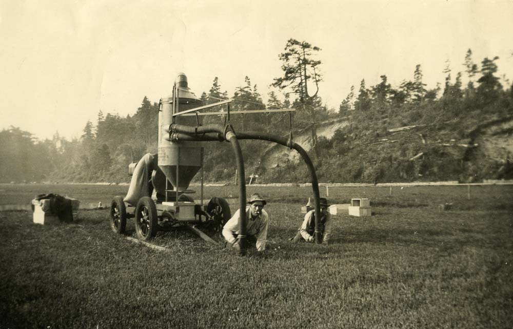
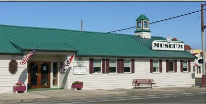
Join us for an in-town hike on the wilder side of Bandon. Follow sidewalks, quiet streets and pathways on a 2.5-mile loop that leads from the Bandon History Museum to a good vantage point to see some cranberry bogs during harvest season. Museum volunteer Jim Proehl will share some “History Minutes” along the way. Expect a sojourn in a cemetery as part of this October hike. Extend the walk by picking up one of several “Healthy, Historic Hike” maps at the museum and following another route through historic Bandon.
Park in the museum parking lot and if that fills up, park in the public lot at Face Rock Creamery or on adjacent streets.
We will meet at 10:00 in Public Parking lot of the Bandon Historical Society Museum. If the lot is full you can find additional parking behind the Face Rock Creamery Map Link to Museum and additional parking area.
Directions – The museum is on the corner of Highway 101 and Fillmore Ave.
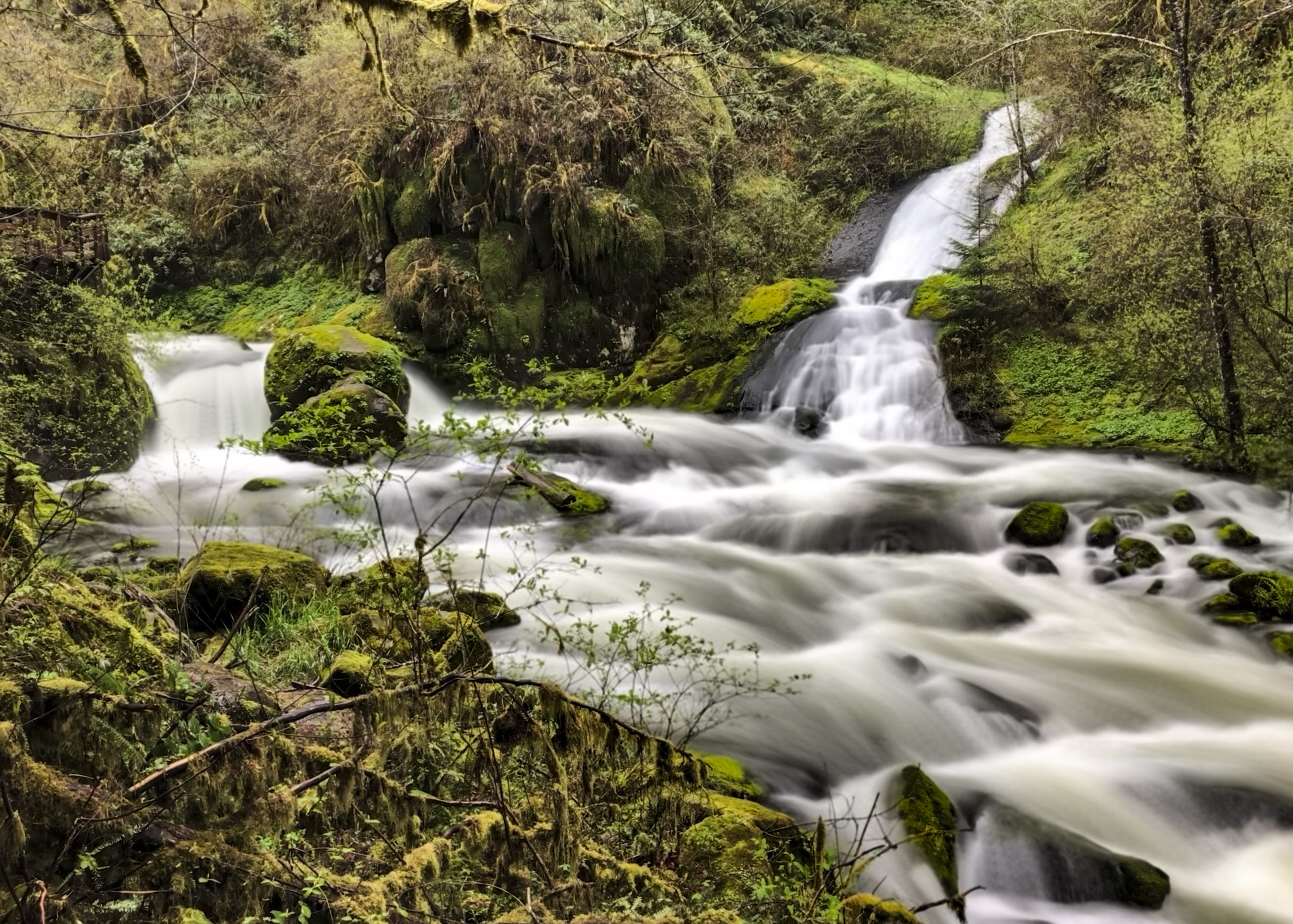
The Hikes: The Sweet Creek/Beaver Creek area offers hikers a smorgasbord mountain stream and waterfalls experience. There will be 3 different hikes all of which are out and back on the same trail and rated moderate.
The first will be a 1.2 mile hike to a viewpoint of Beaver Creek Falls.
The second hike will be 1.6 miles to Sweet Creek Falls. Note–There was a tree blocking the trail, but it has been cleared. The root ball that’s left is slippery, but passable.
The final and best hike of the day will be a hike along Sweet Creek on a trail that meanders along the water and is a chance to see tributary falls that feed the creek, as well as the main attraction. This hike will be a little different from past hikes on this trail. There is a bridge failure along the way, so we’ll be starting at the second parking lot. We’ll still see some gorgeous views.
All together you will hike 4.6 miles for the day as you enjoy 3 beautiful waterfall views.
Since the hikes are all “out and back” you can cut any of the hikes short and return to the parking area if you are getting tired. Plan on 4 hours for all the hikes—starting for home around 2pm.
Bring lunch and water and rain gear, dress in layers, and wear sturdy boots (waterproof is good
Location and Time
Saturday, October 5–Meet at Oregon Dunes Visitor Center in Reedsport at 9:15. We will consolidate, if possible, and caravan from there, so arrive early so that we can group up.
Directions: From Coos Bay Visitor Center in downtown Coos Bay travel 26.6 miles N on Hwy 101. Visitor center is on left directly opposite the turnoff for Hwy 38. We will consolidate vehicles and leave from the Dunes Visitor Center at 9:15, reaching the Beaver Creek Falls trail head at about 10:30 (with one rest stop along the way). Note: If you want to meet us at the trailhead, you can plan to be at the Wagon Road Trailhead at 10:30. Let us know if you plan to do this. (There is a space on the registration form to do this)
This hike is just over 5 miles long, across fairly level terrain, with great views along the way.
For this hike we’ll start at the Cape Blanco State Airport (see directions below), and hike parallel to the runway for a while before heading North, and then looping around toward the shoreline, where we’ll have some of the hike’s best views. Then we’ll continue to Blacklock Point, returning by a shorter trail.
There will be a short option that starts along the same path as the rest of the group, but skips the longer loop, proceeding directly to Blacklock Point. That is an out and back hike, totaling 4 miles altogether.
The differences are shown on the map below.
Dress in layers, windbreaker with a hood is highly recommended. Bring water and something to eat (lunch or a snack.). There are no restrooms at the trailhead, but there are several well protected areas along the way.
Plan on 3 hours for this hike, depending on how clear the day is (there are lots of photo opportunities on a clear day, which could slow us down).
Hike Guidelines
Hike groups will be limited to about 15 people. That’s to make it easier to keep track of everyone as we reach turns.
You will be asked to complete a registration form so that we can control the number.
Location and Time
Meet at 10:00 on Saturday, July 27 at the trailhead just outside of the Cape Blanco Airport Entrance. For those of you heading south on 101, you will turn on Airport Road, about 20 miles south of Bandon. Then follow Airport Road for about 3 miles. If you’re heading North, the turn on Airport Road is about 7.2 miles from Port Orford. Airport road is directly across from Pacific High School.
There are two parking areas. The one on the left isn’t as obvious, but if there are a lot of cars, we may need to use it.
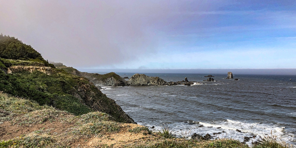
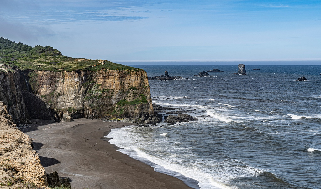
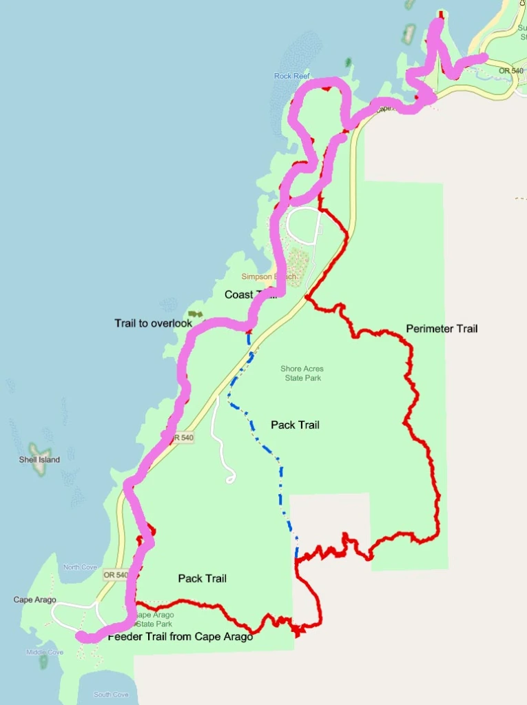
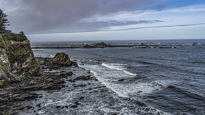
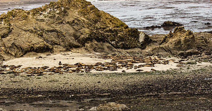
Hike Description: The whole hike goes from Sunset Bay Day Use Area, along the coast through Shore Acres up toward the Simpson Reef Overlook. From there we’ll continue to Simpson Reef and then cross the road to the Pack Trail connector, and on to Cape Arago. That will be a good spot to have lunch. Then you can return either by the same route or along the road as far as the Simpson Reef overlook, returning the same way you came. The total hike is about 8.5 miles if we take the shortcuts across the field at Shore Acres and the group campground at Sunset Bay.
Short Hike–This will just go to Shore Acres and back. It will be under four miles, all pretty level. I need a volunteer to lead the short hike…or you will need to return on your own.
Another option–You can hike as far as Simpson Reef, and then return. This will be almost 8 miles, but it’s all level. You’ll be on your own for the return.
The line on the map shows the route we’ll be taking. Depending on a group decision, we MAY take the Pack Trail from Cape Arago (the red to the blue broken line).
Other Information
Restrooms are available at Sunset Bay and Shore Acres.
For those on the long hike, we’ll be stopping for lunch at Cape Arago. We suggest you might want to snack at the Simpson Reef Overlook, because lunch will be later than usual.
Location and Time
Location and Time
Meet 9:30 am at Sunset Bay day use parking lot, near volley ball courts and restrooms at south end of Sunset Bay. The short version of the hike will end before noon(unless you spend time in the gardens), and the long version at 2:30.
Driving Directions: From Hwy 101 in downtown Coos Bay follow the signs 12.3 miles through Charleston to Sunset Bay State Park. Park in the day use parking lot.
This hike will be a ‘Weather Permitting’ hike, and may be cancelled if the weather is bad. Check this site on the day of the hike for information.
Description
Explore some of the many paths and trails commonly used by the folks in North Bend both past and present.
You can join local author and historian Dick Wagner on an easy to moderate 2 mile loop from Ferry Park, along Bayview Ave and back up into town, before walking through Simpson Park, past the North Bend Visitor Center, under the McCullough Bridge, and then returning through the woods to Ferry Park. Dick literally ‘wrote the book’ (or books) on North Bend History.
We will meet at 10:00 in the Ferry Road Park parking lot.
Directions: Ferry Road is just South of the McCullough Bridge. If you are heading South it will be your first left. If you are heading North, it will be on the right, just past the North Bend Visitor Information Center.
The virtual “race” starts on January 1 and goes through April 15. It’s a fun way to achieve your fitness goals in the new year. You can choose from many types of actual exercise to calculate your virtual miles, and this 3rd Odyssey has new milestones to reach in your 229-mile route around Coos County. Participate as an individual or form teams with friends, family or colleagues to motivate each other to achieve your goals. The entry fee is $25 (plus a $2.50 processing fee). All proceeds go to the Coos County Friends of Public Health for the Nurses’ Purse Fund, which helps families in need in Coos County.
Let’s get moving in 2024!
When you register, you can join a team (like the South Coast Striders), register as an individual, or start your own group or team.